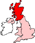
Map of Bonnyrigg Scotland and Surrounding Areas
Detailed street map of Bonnyrigg town centre and the surrounding areas, towns & villages.
 |
||
Bonnyrigg Map Scotland Showing the Town and its Surroundings
Street Map of the Scottish Town of Bonnyrigg: Find places of interest in the town of Bonnyrigg in Midlothian, Scotland UK, with this handy printable street map. View streets in the centre of Bonnyrigg and areas which surround Bonnyrigg, including neighbouring villages and attractions. Large Bonnyrigg map.
Places of interest in and surrounding Bonnyrigg, Midlothian include: Chesters Bog Wood, Lasswade, Bombay Spice Restaurant, Hopefield Primary School, Lasswade Primary School, Hawthornden Primary School, Lasswade High School Centre, Fancy Grove Wood, The A6094, Bonnyrigg Parish Church, Lasswade Rugby Football Club, The B704, Polton, Doghouses Wood, St Leonard's Church Bonnyrigg, Bonnyrigg Flowers (Florist), The CHase Pub, Cockpen, Haveral Wood, Catholes Wood, King George's Field, River North Esk, Bonnyrigg High Street, The Royal Oak, Little Wood, Castle Dean Wood, St Mary's RC Primary School, Bonnyrigg Library, Pittendriech Burn and more.
Highlights of This Bonnyrigg Midlothian Map:
- Easy to Print Map for Town Centre of Bonnyrigg.
- Get a Satellite View of Bonnyrigg.
- Find Routes To and From Bonnyrigg area.
- View Villages and Towns Around Bonnyrigg.
- Identify Bonnyrigg Areas of Interest.
- See Bonnyrigg Housing & Industrial Estates.
- Easily Find Bonnyrigg Tourist Attractions.
- Zoom in, Pan and Move Around Bonnyrigg.
- See Rivers, Canals, Lakes and Waterways.
The Post Code for Bonnyrigg is: EH19
Locate streets and roads in and near Bonnyrigg, locate interesting places and attractions in and near Bonnyrigg, locate churches and religious centres in and near Bonnyrigg, locate hospitals and health centres in and near Bonnyrigg, locate towns and villages surrounding Bonnyrigg area.
More Maps of Scotland:
- Map of Stenhousemuir Area & Surroundings
- Map of Dunbar Area & Surroundings
- Map of Cumbernauld Area & Surroundings
- Map of Prestonpans Area & Surroundings
- Map of Carluke Area & Surroundings
England Town Maps - Spanish Town Maps - Hampshire Town Maps