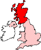
Map of Grangemouth Scotland and Surrounding Areas
Detailed street map of Grangemouth town centre and the surrounding areas, towns & villages.
 |
||
Grangemouth Map Scotland Showing the Town and its Surroundings
Street Map of the Scottish Town of Grangemouth: Find places of interest in the town of Grangemouth in Stirling & Falkirk, Scotland UK, with this handy printable street map. View streets in the centre of Grangemouth and areas which surround Grangemouth, including neighbouring villages and attractions. Large Grangemouth map.
Places of interest in and surrounding Grangemouth, Stirling & Falkirk include: Rannoch Park, Westquarter, RAF Grangemouth, Grangemouth High School, Zetland Park, Laurieston, Macdonald Inchyra Hotel and Spa, Grangemouth Evangelical Church, The A905, The M9 Motorway, Polmont Woods, Inchyra Park, Beancross Primary School, Western Channel, The River Carron, Grandsable Cemetery, Millhall Reservoir, The Project Theatre, The Priory Restaurant, Grangemouth Stadium, The Kirk of the Holy Rood and more.
Highlights of This Grangemouth Stirling & Falkirk Map:
- Easy to Print Map for Town Centre of Grangemouth.
- Get a Satellite View of Grangemouth.
- Find Routes To and From Grangemouth area.
- View Villages and Towns Around Grangemouth.
- Identify Grangemouth Areas of Interest.
- See Grangemouth Housing & Industrial Estates.
- Easily Find Grangemouth Tourist Attractions.
- Zoom in, Pan and Move Around Grangemouth.
- See Rivers, Canals, Lakes and Waterways.
The Post Code for Grangemouth is: FK3
Locate streets and roads in and near Grangemouth, locate interesting places and attractions in and near Grangemouth, locate churches and religious centres in and near Grangemouth, locate hospitals and health centres in and near Grangemouth, locate towns and villages surrounding Grangemouth area.
More Maps of Scotland:
- Map of Renfrew Area & Surroundings
- Map of Denny Area & Surroundings
- Map of Larkhall Area & Surroundings
- Map of Kelso Area & Surroundings
- Map of Prestwick Area & Surroundings
England Town Maps - Spanish Town Maps - Hampshire Town Maps