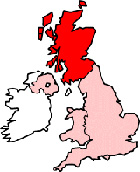
Map of Largs Scotland and Surrounding Areas
Detailed street map of Largs town centre and the surrounding areas, towns & villages.
 |
||
Largs Map Scotland Showing the Town and its Surroundings
Street Map of the Scottish Town of Largs: Find places of interest in the town of Largs in North Ayrshire, Scotland UK, with this handy printable street map. View streets in the centre of Largs and areas which surround Largs, including neighbouring villages and attractions. Large Largs map.
Places of interest in and surrounding Largs, include: Largs Golf Club, Largs Bay, Largs Parish Church of St John, Largs Station, Haylie River, Largs Academy, Largs Library, Main Street Largs, St Leonards Guest House, The Firth of Clyde, Largs Railway Station (Train Station), Netherhall, Castle Bay, Largs Ferry Terminal, St Mary Star of the Sea RC Church and more.
Highlights of This Largs North Ayrshire Map:
- Easy to Print Map for Town Centre of Largs.
- Get a Satellite View of Largs.
- Find Routes To and From Largs area.
- View Villages and Towns Around Largs.
- Identify Largs Areas of Interest.
- See Largs Housing & Industrial Estates.
- Easily Find Largs Tourist Attractions.
- Zoom in, Pan and Move Around Largs.
- See Rivers, Canals, Lakes and Waterways.
The Post Code for Largs is: KA30
Locate streets and roads in and near Largs, locate interesting places and attractions in and near Largs, locate churches and religious centres in and near Largs, locate hospitals and health centres in and near Largs, locate towns and villages surrounding Largs area.
More Maps of Scotland:
- Map of Thurso Area & Surroundings
- Map of Paisley Area & Surroundings
- Map of Bathgate Area & Surroundings
- Map of Glenrothes Area & Surroundings
- Map of Montrose Area & Surroundings
England Town Maps - Spanish Town Maps - Hampshire Town Maps