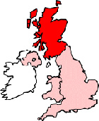
Map of Lockerbie Scotland and Surrounding Areas
Detailed street map of Lockerbie town centre and the surrounding areas, towns & villages.
 |
||
Lockerbie Map Scotland Showing the Town and its Surroundings
Street Map of the Scottish Town of Lockerbie: Find places of interest in the town of Lockerbie in Dumfries & Galloway, Scotland UK, with this handy printable street map. View streets in the centre of Lockerbie and areas which surround Lockerbie, including neighbouring villages and attractions. Large Lockerbie map.
Places of interest in and surrounding Lockerbie, Dumfries & Galloway include: Kennel Wood, All Saints Church Lockerbie, Potspool Wood, The Flower Pot (Florists), Lockerbie Railway Station (Train Station), Lockerbie Golf Club, Lockerbie Station, Lockerbiehouse Wood, Lockerbie High Street, Lockerbie Dental Surgery, Lockerbie Post Office, The A74 Motorway, Dryfesdale Parish Church, Lockerbie Police Station, The Crown Hotel, The Kings Arms, The A709, Farquar Moss Wood, Gimmerbie Wood, The B723, Craw Wood, The Brig Inn Pub, Bengall Covert, The River Annan, Holy Trinity Roman Catholic Church, Kirkton Wood, Lucky Rainbow Restaurant, Corrie Lodge Country House B&B, Tarras Guest House, Fox Covert, King Edward Park and more.
Highlights of This Lockerbie Dumfries & Galloway Map:
- Easy to Print Map for Town Centre of Lockerbie.
- Get a Satellite View of Lockerbie.
- Find Routes To and From Lockerbie area.
- View Villages and Towns Around Lockerbie.
- Identify Lockerbie Areas of Interest.
- See Lockerbie Housing & Industrial Estates.
- Easily Find Lockerbie Tourist Attractions.
- Zoom in, Pan and Move Around Lockerbie.
- See Rivers, Canals, Lakes and Waterways.
The Post Code for Lockerbie is: DG11
Locate streets and roads in and near Lockerbie, locate interesting places and attractions in and near Lockerbie, locate churches and religious centres in and near Lockerbie, locate hospitals and health centres in and near Lockerbie, locate towns and villages surrounding Lockerbie area.
More Maps of Scotland:
- Map of Kilbirnie Area & Surroundings
- Map of Bothwell Area & Surroundings
- Map of Greenock Area & Surroundings
- Map of Crieff Area & Surroundings
- Map of Cowdenbeath Area & Surroundings
England Town Maps - Spanish Town Maps - Hampshire Town Maps