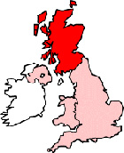
Map of St Andrews Scotland and Surrounding Areas
Detailed street map of St Andrews town centre and the surrounding areas, towns & villages.
 |
||
St Andrews Map Scotland Showing the Town and its Surroundings
Street Map of the Scottish Town of St Andrews: Find places of interest in the town of St Andrews in Fife, Scotland UK, with this handy printable street map. View streets in the centre of St Andrews and areas which surround St Andrews, including neighbouring villages and attractions. Large St Andrews map.
Places of interest in and surrounding St Andrews, Fife include: The Royal & Ancient Golf Club St Andrews, University of St Andrews Library, Kinness Burn, David Russell Apartments, The A917, The A915, The Seafood Restaurant, Brooksby Guest House, St Andrews Bowling Club, St Andrews Cathedral, Fife Park, Cockshaugh Public Park, St Andrews Tourist Hostel, The Russell Hotel, The Trust Museum and Garden, The New Picture House Cinema, St Andrews Bowling Club, Market Street St Andrews, Albany Park, St James Church, University Hall, John Burnet Hall, Brownhills, University of St Andrews, The British Golf Museum and more.
Highlights of This St Andrews Fife Map:
- Easy to Print Map for Town Centre of St Andrews.
- Get a Satellite View of St Andrews.
- Find Routes To and From St Andrews area.
- View Villages and Towns Around St Andrews.
- Identify St Andrews Areas of Interest.
- See St Andrews Housing & Industrial Estates.
- Easily Find St Andrews Tourist Attractions.
- Zoom in, Pan and Move Around St Andrews.
- See Rivers, Canals, Lakes and Waterways.
The Post Code for St Andrews is: KY16
Locate streets and roads in and near St Andrews, locate interesting places and attractions in and near St Andrews, locate churches and religious centres in and near St Andrews, locate hospitals and health centres in and near St Andrews, locate towns and villages surrounding St Andrews area.
More Maps of Scotland:
- Map of Alloa Area & Surroundings
- Map of Cupar Area & Surroundings
- Map of Ardeer Area & Surroundings
- Map of Bearsden Area & Surroundings
- Map of Dalkeith Area & Surroundings
England Town Maps - Spanish Town Maps - Hampshire Town Maps