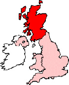
Map of Stornoway Scotland and Surrounding Areas
Detailed street map of Stornoway town centre and the surrounding areas, towns & villages.
 |
||
Stornoway Map Scotland Showing the Town and its Surroundings
Street Map of the Scottish Town of Stornoway: Find places of interest in the town of Stornoway in W Isles, Scotland UK, with this handy printable street map. View streets in the centre of Stornoway and areas which surround Stornoway, including neighbouring villages and attractions. Large Stornoway map.
Places of interest in and surrounding Stornoway, W Isles include: New Valley, Stornoway Sheriff Clerk's Office, Raon Goilf Golf Course, Stornoway Ferry Terminal, The Museum Nan Eilean, Free Church of Scotland, Church of Jesus Christ of Latter Day Saints, Plasterfield, Sandwick New Cemetery, The A866, The Digby Chick Restaurant, St Columbas Church, The Park Guest House & Restaurant, Quay Street Stornoway, Stornoway Police Station, Goatmill Park, Sandwick, The A857, Stornoway Sea Angling Club, Stornoway Visitor Information Centre, The Western Isles Hospital and more.
Highlights of This Stornoway W Isles Map:
- Easy to Print Map for Town Centre of Stornoway.
- Get a Satellite View of Stornoway.
- Find Routes To and From Stornoway area.
- View Villages and Towns Around Stornoway.
- Identify Stornoway Areas of Interest.
- See Stornoway Housing & Industrial Estates.
- Easily Find Stornoway Tourist Attractions.
- Zoom in, Pan and Move Around Stornoway.
- See Rivers, Canals, Lakes and Waterways.
The Post Code for Stornoway is: HS1
Locate streets and roads in and near Stornoway, locate interesting places and attractions in and near Stornoway, locate churches and religious centres in and near Stornoway, locate hospitals and health centres in and near Stornoway, locate towns and villages surrounding Stornoway area.
More Maps of Scotland:
- Map of Bishopton Area & Surroundings
- Map of Strathaven Area & Surroundings
- Map of Perth Area & Surroundings
- Map of Rutherglen Area & Surroundings
- Map of Bishopbriggs Area & Surroundings
England Town Maps - Spanish Town Maps - Hampshire Town Maps